Locate Your Ecodistrict
Click on the map below to locate your ecodistrict and download the Local Native Species List for your area. An ecodistrict is an area of land and water defined by its physical features, including bedrock, surface geology and topography as well as local climate patterns, due to e.g. lake effect, elevation and latitude. These features play a major role in determining patterns of species presence, association and the habitats that develop.
What is a native species?

Native species of southcentral Ontario existed here prior to European settlement and are adapted to local conditions. Ontario’s diverse topography, climate and soils are reflected in a diverse mix of vegetation, largely dominated by forests with many woody plant species – in fact over 150 native trees and shrubs.
The term native often has a political connotation, e.g. native to Ontario; but given the size of Ontario, this is less than helpful. Indigenous is often used interchangeably with native but it has a more useful, locally significant meaning. An indigenous species is adapted to local conditions such as a river watershed, or even more specifically, to the bottom slopes of the river valley.
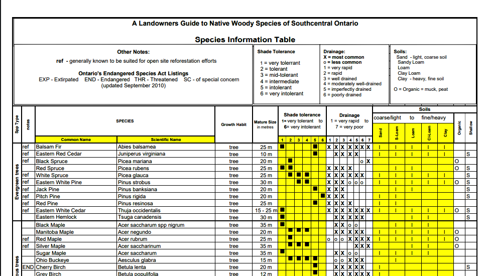
Species Info Table
For a complete list of the Ontario’s many native woody species, including basic information about each species, download: Species Information TABLE

Resources
EcoZone Definitions
For more detail on definitions of Ontario’s Eco zones, Eco regions, and Eco districts visit Introduction to Ecological Land Classification Systems
Landowner Guide
The Landowners Guide to the Native Woody Species of Southcentral Ontario provides more detail including:
- What is a native species?
- Why should you care about native species?
- Describing your site
- Is Your Site Native?
- Describing Ontario’s forests
- A Species List for Your Area
- Choose species for planting projects